
All and Sundry, a Bunch of Walks Around Fort William
So, this is a collection of mini-reports and/or part journal. The link to the walk represents one of four that I did before I started the Great Glen Way in May 2017. There will also be a report of the three days at the beginning of the West Highland Way, and a report on revisiting of the Trotternish Ridge…stay tuned.
Day 0: Imagine my joy upon arriving at the Glasgow airport, and re-meeting the most charming and helpful, Visit Scotland Ambassador Laura; better still, she REMEMBERED us from last year’s luggage fiasco!! Of course she sorted all our bus passes and reservations until our trip up to Skye, and I am convinced her natural good karma rubbed off, which meant they found me a seat on that first bus up to Fort William. What an absolute peach. I was more relaxed on the bus than the plane, and did manage to snooze. But arrived in Fort William and set myself up for my stay – bed, phone and food, not in that order.
Day 1: Taking the bus back to Clianlarich the next morning did not appeal, but I felt it wise to stick to the schedule. My trouble was rewarded with a visit to the beautiful Ewich House, between Crianlarich and Tyndrum, the nicest B n B owners, and an all over visit of the Tyndrum Inn. Oh yes, and those lovely ladies at the Crianlarich Hotel from…somewhere further east, on a 4-5 day bus trip; all polyester clothes, sensible shoes and a happy dose of interest in the things they were seeing. The real reward though was the walk from Tyndrum to Bridge of Orchy

– my first love of the West Highland Way – on my first trip, this was the first leg of a Tyndrum to Kings House walk, and where I was gobsmacked by the barren hills of the Highlands.

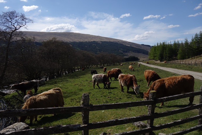
I stopped for my carefully prepared albeit unsalted chicken sandwich, watched some gamboling calves (not lamb’s) and chatted with a couple of seemingly tired out scots who were suffering from their walk.
At the Bridge of Orchy, I got a pint, and chatted in the sun outside with a nice fellow from Glasgow, who had blown his knee, and was waiting, like me, for the bus north. Yes, sitting in the sun, because the weather has been magnificent – 18-20 degrees, full sun – I have nothing to wear!! All trousers, no shorts. I may ask Tim to bring me out my comfy shorts, and my running shoes, and and…it’s ok, she owes me; last year I brought out all her hiking stuff, as well as her summer wardrobe, and took back the former along with the winter wardrobe – in the end, I had more of her stuff than mine. But it was worth the company on last year’s adventure (read about the Skye Trail …)
Day 2: I was heading out to Aite Cruinnichidh mid-afternoon, and after insuring my bags and food were properly sorted, I set out for a little stroll around Cow Hill, there was an access just next to the hostel, and I figured, why not.

It was actually a good workout for a non-hill walker. 11 kilometers, with an excellent view of Glen Nevis, and the town from various points around the hill.

An unexpected bonus of the Cows Hill Link, a walk along the NE forested flank, which was a cool relaxing break from the rest of the walk (did I mention the weather? Hot and sunny?). I had a nice lunch at the hostel, and went for a last small shop before grabbing the bus to Roybridge (Bridge over the river Roy). My host at Aite Cruinnichidh, picked me up from the station and brought me to this lovely clean calm spot with Cnap Cruin (or Beinn Chlianaig still not sure) filling the background. After a slow start (socially) I ended up in the ‘library’ with some fellow guest, including my trio of adorable Argentinian roommates, answering Trivial Pursuit questions. I was playing it coy, set up in there all alone, trying to download pictures off my camera, when they joined me. Not exactly, the ‘may I join you’ dictum of solo travels (see note), but effective nonetheless.
Day 3: The walk up Cnap Cruin (Beinn Chlianaig) Let me make a clean breast of it; a hill walker, I am not. A wild camper even less. I think I should be, but my patience and resolve are not my finest attributes. I longingly read about all the Scottish adventurers, and imagine myself in their place, and by that I mean their destination, realising that one rarely hears about the slog up, or down, which is in fact the longest part of any of these journeys. It’s not quite like childbirth which erases the memory of the actual pain (never mind the pregnancy). Not for me. I still haven’t resolved to actually ‘like’ what we in Canada call ‘hiking’. At the risk of repeating myself, hiking at home has its own set of problems; namely the slogging is usually in the woods, with nothing to look at but tree trunks and your feet. At least here, in Scotland, you are blessed almost continuously with a view. So my host, kindly lent me a map of the area, which included the two gentle peaks behind the bunkhouse. When I pressed him for more indications of the way to follow, he just pointed up. ‘However you like, that’s what it’s about isn’t it, right to roam, you can go where you please’.

Maybe not the most reassuring words for a novice, but ones I repeated to myself every time I chose a new direction, or climbed through a fence – and it actually got me to the top.

And it was perfect, for me. Interesting in itself, with its strange rock formations and pools, the views to the amazing hills around it;

Cruach Innse and Sgurr Innse ,the Grey Cories, and beyond, all the way to Fort William. It might not always be that reasonable a walk – it was very dry, so little bog and mud. I came down a far steeper route than the one I took up, with little consequence, AND I saved a lamb, I think, from ending its days in the stream bed, while its sheep parent, looked on confused. I felt great and accomplished and not at all shabby, sitting around afterwards in the sun. with my book and beer and chips. Given my day, I felt bold enough to use the ‘I don’t want to eat alone’ in its most blunt version, and had a great evening parallel eating, (we didn’t collaborate) and learning new games. (Dominos for points and **** Storm??)
Day 5: Scheduled as alternate Tyndrum day, but since that happened as planned, It became a logistical, possibly walk day. And it were that! Hit up all the outdoor stores in Fort William looking for maps, and map holders; ended up with a Great Glen Way and a Skye Trail map. Also ended up with enough time to contemplate a stroll over the West Highland Way from Fort William to Kinlochleven. This is another of the highlights of the WHW, removed at it is from roadways along most of its length. I choose to start from the youth hostel, a ‘smart’ short cut I thought I had found, using the Cow Hill circuit Link…only not so smart in fact. But I digress. So once on the trail, I started with that smooth, wide ascent that passes the Dun Deardail fort. Given my late start, and path diversion, I decided to skip a visit, and moved up and through this mostly direct section. Once on the specific WHW path, I did have to endure the ongoing forestry work which you can find across the highlands. It is hard to remember that forestry is a sustainable, and renewable industry when it insists on ruining your perfect view of the peaks in the background.
But the beauty is still overwhelming, once out of the first (or final, depending on your direction) clearcut bowl.

In fact, since my first traverse three years ago I would say it has improved, being somewhat greener, softer than it was earlier. I thought a lot about my right to roam through the remaining stumps I passed along the way…a real walk blocker if I ever saw one. I finally emerged into what I remember as a green, smoothy smooth, pasture area,

still between the hills close by on my left, and the view open to the Blarmachfoldach my right. From this distance the clear cut looks like a deliberate pattern on the distant hills.
The pastoral switches up to forested, and back again, until the path curves towards the left, (or east, as the case may be) and I am finally in the valley at the foot of the western Mamores and Tom nan Corp and Beinn na Caillich . The peaks, which will take eons to pass (or so it would feel) stand out rounded, or jagged or like a carved rock face.

The walking is fairly straight forward, but the path is very rocky, meaning we are continuously looking for the best path, on the verge, down the centre, wherever. It also means one had best stop to be overwhelmed by the views. As is my custom, I am looking for the paths up these nameless hills, trying to calculate distance in from Kinlochleven (1 hr 45 min) for some of the more obvious ones. I worry about my future clients. They need to be part warrior to prevail on this path, and I am confident that those that are not yet, will be once they reach this last day of the West Highland Way. There is the descent into Kinlochleven, will be a considerable ascent for my future friends, but I know what awaits them, and I have no doubt that all will be forgiven and forgotten, once they are in Lairig on their way to Fort William.